Building & Bylaw ServicesCorporate Services Current PlanningDrinking Water & Watershed ProtectionEconomic DevelopmentEmergency ServicesEnergy & SustainabilityGIS/MappingLong Range PlanningParksRecreationRegional TransitSolid Waste and RecyclingWastewater ServicesWater & Utility ServicesServices by Others
RDN Watersheds
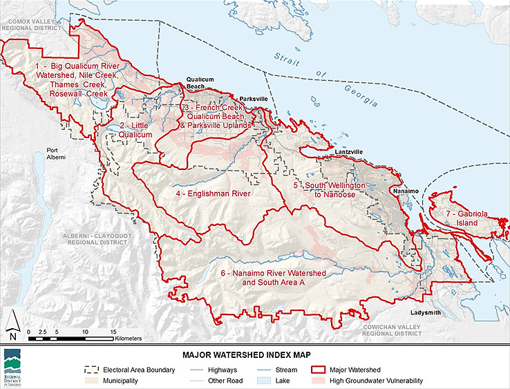
The RDN can be divided into 7 major watershed areas. In these watershed areas there are also sub watersheds. Find your area and select it below to learn more:
- Big Qualicum River Watershed, Nile Creek, Thames Creek, Rosewall Creek
- Little Qualicum
- French Creek and Grandon Creek
- Englishman River
- South Wellington to Nanoose
- Nanaimo River Watershed and South Area A
- Gabriola Island
The City of Nanaimo has more detailed information about their watersheds, here: City of Nanaimo Watersheds.
Want More Technical Information?
- RDNWaterMap is a web GIS tool that has more detailed information on water resources in the Regional District of Nanaimo.
- The Water Budget Phase 1 study is a preliminary look at water supply and demand in our region, that assigns relative stress assessments to help with prioritizing actions in our water regions.