Watershed 7: Gabriola Island
The Gabriola Watershed comprises Gabriola Island, a populated island off the east coast of Nanaimo. It is approximately fifty-three square kilometres of low altitude terrain in the Coastal Douglas-fir Biogeoclimatic zone. Winters are mild and wet and summers are prone to drought. Overall, precipitation is low because it lies in the rainshadow of the Vancouver Island mountain ranges.
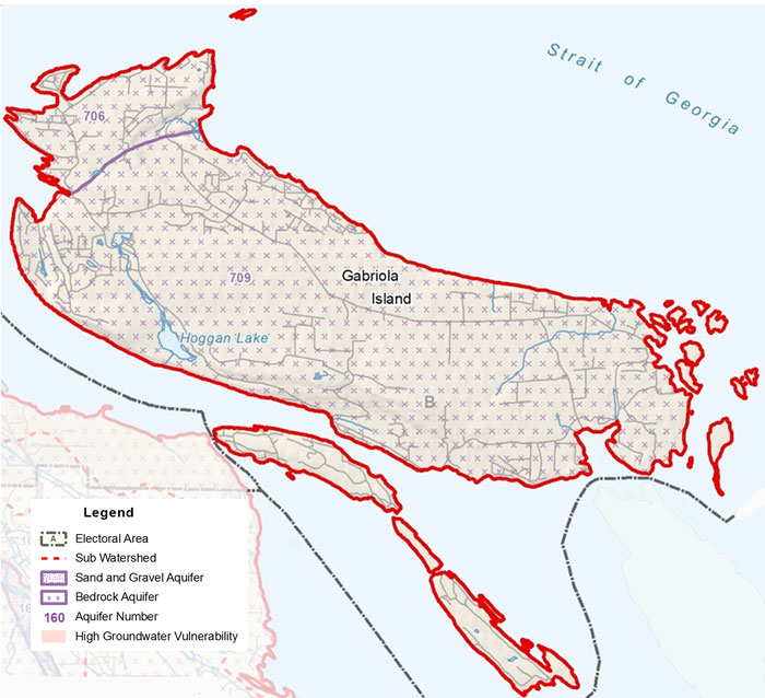
Surface Water
Surface water is stored in five lakes and seven wetlands that together make up just over two percent of the area. Drainage occurs vertically into the aquifer and horizontally through the stream network into the Salish Sea. Coats Marsh is a rare Gulf Island wetland with rare stands of Coastal Douglas fir that is now protected as an RDN Regional Park. Two creeks run through the property and eventually connect to Hogan Lake. Some residences on Gabriola have water licenses to extract surface water for their domestic needs.
Aquifers
Gabriola's groundwater, derived solely from rainwater, is stored in many small independent aquifers made up of either shale or sandstone. The Gulf Islands do not have high mountains with winter snow, which store water well into the summer months. There are also few lakes and rivers, so the only real water storage is underground in cracks in the rocks. Water is stored in fractures or open spaces between the rocks and generally moves outward from the centre of the island. As precipitation declines in the summer months, the water table becomes lower, resulting in wells drying up or salt-water intrusion in deeper wells. Many residents create their own summer storage by using cisterns to store rainwater.
- Click Here to download a fullsize version of this map (1.2MB)
- Go to www.rdnwaterbudget.ca for the Gabriola Island PHASE 1 WATER BUDGET STUDY (2003)